
GPS jamming in space is an emerging navigation-warfare concern. New research shows that radio-frequency interference from Earth can degrade Global Navigation Satellite System (GNSS) signals received by satellites in low Earth orbit (LEO). This cross-domain vulnerability links terrestrial electronic warfare to spacecraft operations. It can affect orbit determination, Earth-observation positioning and the accuracy of satellite-derived data.
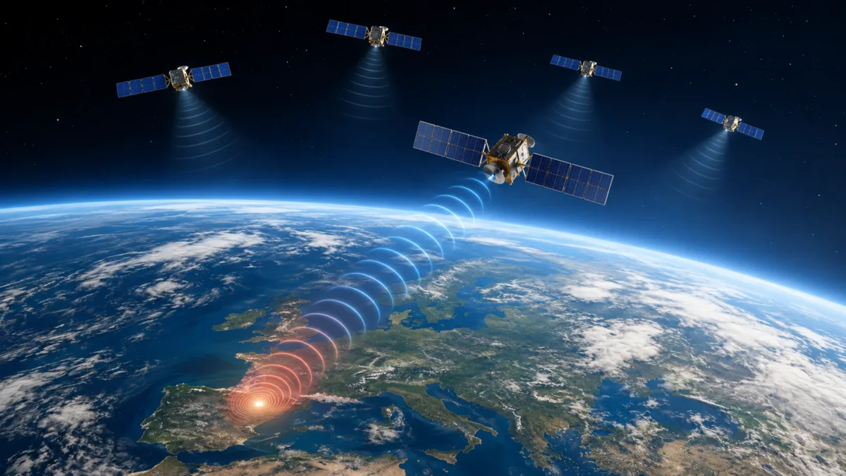
However, not every episode of GPS jamming targets space infrastructure. The available evidence also does not prove that operators deliberately directed the observed interference at satellites. The finding is more precise: terrestrial interference can reach orbit and disrupt spaceborne receivers, creating effects beyond the original target environment.
What Is GPS Jamming in Space?
GPS jamming in space occurs when radio-frequency interference degrades or blocks navigation signals received by a satellite in orbit. GPS is the United States’ system. GNSS is the broader term for GPS, Europe’s Galileo, Russia’s GLONASS and China’s BeiDou.
Many satellites in LEO use signals transmitted by navigation satellites in medium Earth orbit to estimate their own position, velocity and time. These measurements support orbit determination, instrument pointing, image geolocation, timing and other spacecraft functions. A satellite may therefore depend on navigation signals that are extremely weak by the time they reach its receiver.
GPS jamming in space does not require physical contact with a spacecraft. A strong terrestrial signal can disrupt the radio-frequency environment around its receiver. That interference can prevent the receiver from tracking weak navigation signals.
How Can a Ground-Based Jammer Affect a Satellite Hundreds of Kilometres Above Earth?
The vulnerability stems from the way satellite navigation works. GNSS satellites broadcast signals across large areas of the Earth and into space. By the time these signals reach a LEO spacecraft, they have travelled a considerable distance and arrive at very low power levels. A terrestrial transmitter producing interference in or near the relevant frequency bands can, under suitable geometric and propagation conditions, raise the noise level at the spacecraft receiver and make navigation signals harder to detect or track.
In other words, the satellite is not receiving GPS from the ground. It is receiving navigation signals from GNSS satellites above it, while interference from a terrestrial source can enter the receiver’s operating environment from below. The relative signal strength, antenna pattern, frequency overlap, transmitter characteristics, spacecraft orientation and receiver design all influence the outcome.
This is one reason the effect should not be described as universal. Not every jammer will affect every spacecraft, and not every satellite uses GNSS in the same way. The observed impact depends on the receiver architecture and the specific interference environment.
What the 2026 Research Found
A study titled Characterization of GNSS Interference in LEO over Europe examined openly available navigation observations from several space missions. Researchers presented the paper at the 2026 Advanced Maui Optical and Space Surveillance Technologies Conference. The researchers used data from the ESA Swarm constellation, Copernicus Sentinel satellites and GNSS radio-occultation missions to assess interference patterns across different receivers, orbits and GNSS observations.
Researchers identified recurring and geographically concentrated degradation signatures over Europe, especially in and around Eastern Europe. Several missions showed lower carrier-to-noise measurements. In some cases, interference erased GNSS observations. Similar patterns appeared across receiver types, orbital paths, GNSS constellations and frequency bands. This suggests that the phenomenon extends beyond one spacecraft or navigation system.
The authors linked the recurring pattern to one or more possible terrestrial sources in the broader western Russia and/or eastern Ukraine region. However, signal behaviour alone cannot identify a specific transmitter or operator. Their multi-year analysis also found that interference expanded geographically and occurred more often. Noticeable degradation began in 2024.
These findings expand the discussion beyond aviation and maritime users. GPS jamming in space shows that researchers can measure terrestrial interference from orbit. The same interference can also degrade navigation observations used by spacecraft.
Jamming Is Not the Same as Spoofing
Jamming and spoofing are both forms of GNSS interference, but they produce different effects. Jamming raises interference levels and can prevent a receiver from acquiring or maintaining a genuine navigation signal. Spoofing involves transmitting counterfeit navigation signals intended to make a receiver calculate false position or timing information. A receiver affected by jamming may lose reliable navigation data; a receiver deceived by spoofing may continue operating while relying on misleading measurements.
The distinction is operationally important. Operators can detect GNSS signal loss through receiver status, signal-quality measurements and comparisons with other navigation sources. Deceptive data can be more difficult to identify if the receiver’s integrity checks and independent references are inadequate. The 2026 European LEO study principally characterises signal degradation and interference. We should not interpret its results as proof that the observed events involved successful satellite spoofing.
Why Satellite Operators Should Be Concerned
1. Orbit determination and spacecraft control
GNSS measurements help many LEO spacecraft determine their position and velocity. When those measurements become unavailable or less reliable, operators may have to rely more heavily on alternative navigation solutions, ground-based tracking or onboard models. The effect will vary by mission: some spacecraft can tolerate intermittent GNSS outages, while others may experience reduced precision or increased operational workload.
2. Earth-observation accuracy
Earth-observation systems need accurate information about where and when an image was collected. Errors in position or timing can complicate geolocation and the integration of imagery with other datasets. This matters for applications such as weather analysis, environmental monitoring, disaster response, infrastructure assessment and security-related observation. GNSS disruption does not automatically make an image unusable, but it can increase uncertainty and the need for independent correction or validation.
3. Communications and payload pointing
Some spacecraft use precise position and timing information to support antenna pointing, payload operations and coordination with other systems. A loss of navigation measurements may therefore affect functions beyond the navigation receiver itself. The extent of the impact depends on how closely those functions rely on GNSS and what backup capabilities the spacecraft carries.
4. Constellation-wide exposure
Multiple satellites may encounter interference as they pass over an affected region. A recurring source may therefore produce repeated episodes across a constellation rather than a single isolated event. This does not mean that every spacecraft will be affected equally: orbital altitude, pass geometry, antenna configuration, receiver sensitivity and signal-processing techniques all shape exposure.
The Strategic Significance: Electronic Warfare Has Cross-Domain Effects
The most consequential lesson is that the boundary between terrestrial electronic warfare and space-system resilience is more porous than operators may assume. A jammer deployed to disrupt navigation for aircraft, ships or land forces can also affect spaceborne receivers if its emissions reach the relevant signals and frequencies. The resulting effect may be unintended, but it can still degrade services delivered by satellites.
This creates a difficult problem for military planners and civilian operators. The same satellite infrastructure may support commercial communications, weather forecasting, mapping, disaster response and national-security missions. Interference that affects one region can therefore produce consequences for users well beyond the immediate area of a conflict. The risk is not limited to the deliberate targeting of a satellite; it also includes spillover from electronic warfare activity conducted against other users of the electromagnetic spectrum.
It is also important to distinguish interference from an anti-satellite attack. GNSS jamming does not physically destroy a spacecraft, and evidence of degraded navigation signals does not establish an attempt to disable a satellite. It is better understood as a non-kinetic interference risk to a space-dependent service. That distinction matters for attribution, escalation assessment and the design of appropriate responses.
How Can Satellite Operators Improve GNSS Resilience?
No single technical measure can eliminate the risk. Resilience depends on combining independent sources of navigation information, robust receiver design, interference monitoring and operational procedures that allow a spacecraft to continue functioning when GNSS quality declines.
- Multi-constellation reception: Using signals from more than one GNSS can improve availability, although it is not a complete defence when interference affects overlapping frequency bands or multiple systems.
- Independent navigation: Inertial sensors, onboard orbit propagation and other independent measurements can help bridge periods when GNSS observations are degraded or unavailable.
- Receiver integrity monitoring: Spacecraft should assess signal quality and measurement consistency rather than treating every navigation solution as trustworthy.
- Interference detection and reporting: Operators can monitor carrier-to-noise changes, loss-of-lock events and recurring geographic patterns to identify exposure and support wider situational awareness.
- Operational contingency planning: Mission teams should define how spacecraft will operate during GNSS outages, including which functions can continue, which require reduced precision and when ground intervention may be needed.
- Independent validation: Earth-observation products and other precision-dependent outputs should use cross-checks and quality indicators when navigation data are degraded.
Mission designers should build these measures into spacecraft design and planning. Operators should not wait until interference appears. The growing use of large satellite constellations makes consistent monitoring and resilience testing especially important.
From Navigation Disruption to Space Situational Awareness
The emergence of space-based monitoring tools adds another dimension to the problem. LEO satellites can provide observations of the GNSS signal environment over wide geographic areas, complementing terrestrial monitoring networks. Researchers at the Technical University of Denmark developed the SAT-JAM map. It uses publicly available satellite navigation observations to visualise where spacecraft encounter interference in orbit.
Such tools help researchers identify recurring patterns, compare observations across missions and alert operators to changing interference conditions. They do not provide automatic attribution. A map showing detected interference does not, by itself, prove the transmitter’s identity, the operator’s intent or the legal character of an incident. Reliable attribution requires additional technical and contextual evidence. Our related analysis explains the difference between satellite jamming and spoofing and outlines the wider range of counterspace capabilities.
Conclusion: A New Dimension of GNSS Vulnerability
Many low Earth orbit satellites depend on GPS and other GNSS services. The 2026 European study shows that terrestrial radio-frequency activity can degrade navigation observations in space. In some cases, receivers lose measurements altogether. This matters to spacecraft operators, but the evidence needs careful interpretation. Interference detection alone does not prove deliberate targeting or identify a responsible actor.
The strategic implication is clear. Navigation warfare can affect systems beyond its intended targets. As societies and armed forces depend more on satellite-enabled services, operators must protect space systems against more than direct attacks. They must monitor the electromagnetic environment, build independent navigation capabilities and prepare for terrestrial electronic-warfare spillover. This challenge also intersects with the risks discussed in our analysis of co-orbital anti-satellite weapons.
Frequently Asked Questions
Can GPS jamming in space affect satellites in orbit?
Yes. Research using satellite navigation observations has identified terrestrial GNSS interference that degrades signals received by some satellites in low Earth orbit. The effect depends on transmitter characteristics, signal frequencies, geometry, antenna design and receiver resilience.
Do satellites in low Earth orbit use GPS?
Many LEO satellites use GNSS signals, including GPS and other navigation constellations, to estimate their position, velocity and time. These measurements support orbit determination and mission functions such as Earth-observation geolocation and payload operations.
What is the difference between GNSS jamming and spoofing?
GPS jamming in space can disrupt genuine navigation signals and cause a receiver to lose signal lock or fail to obtain a reliable solution. Spoofing uses counterfeit signals to mislead a receiver into calculating false navigation information.
Does satellite GNSS interference mean an anti-satellite attack has occurred?
No. GNSS interference can affect satellite receivers without physically attacking or damaging a spacecraft. It may be an unintended consequence of terrestrial electronic warfare. Evidence of interference alone does not establish deliberate anti-satellite intent.
How can satellites navigate when GNSS signals are disrupted?
Depending on their design, satellites can use inertial sensors, onboard orbit models, alternative tracking methods and ground-based support to maintain or reconstruct navigation solutions. These alternatives may not provide the same accuracy or continuity as GNSS under all conditions.
One Response